Professional Aerial Photography
See Your Property From a Whole New Perspective
in Waupun, WI
If you’ve ever wondered what your home, farm, or land looks like from above, our aerial photography services in Waupun, Wisconsin provide stunning, high-resolution drone images that capture your entire property in one view. Whether for personal curiosity, documentation, or marketing, we deliver safe, professional drone imaging throughout Dodge County and surrounding areas.
What You Can See From Above
- Full Property Layout
Aerial photography shows your entire property in one clear view — including buildings, driveways, landscaping, and surrounding land — giving a true sense of size, layout, and positioning. - Property Lines & Land Features
See fence lines, acreage, wooded areas, ponds, fields, and elevation changes that aren’t visible from ground level. Perfect for rural properties and larger lots in Waupun and surrounding areas. - Seasonal Landscape Views
Capture your property in every season — from lush summer greenery to snowy Wisconsin winters — adding visual variety and year-round appeal.
Who This is Perfect For
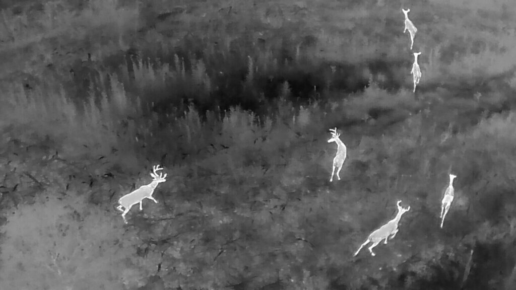
- Hunting & Wildlife Properties
View wooded areas, trails, and habitat layout for better land management. - Homeowners
See your home and property from above with professional aerial photography in Waupun, WI. - Farmers
Get a full-field view of crops, drainage, fence lines, and overall land layout. - Landowners Selling Acreage
Showcase property boundaries, terrain, and access points with clear drone images. - Construction Projects
Document build progress with detailed overhead photography.
A Trusted Option
- FAA Part 107 Certified
Fully licensed drone pilot operating legally and professionally. - Insured & Compliant
Protected coverage and safe flight practices for every project. - Local to Waupun
Based in the Waupun, WI area and familiar with the local landscape. - Fast Turnaround
Quick scheduling and prompt delivery of edited aerial images. - Clear Communication
Simple process, upfront expectations, and responsive updates from start to finish.
Service Area
- Fond du Lac County
- Dodge County
- Green Lake County
- South Central Wisconsin
Note mileage rates apply over 40 miles.
- Contact Form
- +1 920.210.8602
- info@lastlightrecovery.com
- Find Us on Google
Frequently Asked Questions
What types of properties do you photograph?
We capture aerial drone images of:
- Residential homes
- Farms and agricultural land
- Rural properties
- Commercial buildings
- Construction sites
- Vacant land and large acreage
How much does aerial photography cost around Waupun, WI?
Pricing depends on property size, location, and project scope. Most residential aerial photography projects in South-Central Wisconsin are affordable and completed in a single visit. Fill out a contact form for a custom quote based on your property size and imaging needs.
How long does an aerial photography session take?
Most aerial photography sessions around Waupun, WI take between 30–60 minutes depending on property size and weather conditions. Larger farms or multi-angle commercial projects may require additional time.
Do I need to be home during the drone photography session?
In most cases, you do not need to be present as long as we have permission to access and photograph the property. However, you’re welcome to be there if you’d like specific angles or features highlighted.
Are you licensed and insured to operate drones in Wisconsin?
Yes. We operate in full compliance with FAA regulations and carry proper insurance coverage. Our drone pilot follows all safety guidelines to provide legal, professional aerial photography services throughout Wisconsin.