Wildlife Assessments
State-of-the-Art Thermal Drone Technology
Professional & Ethical Data Collection
in Waupun, WI
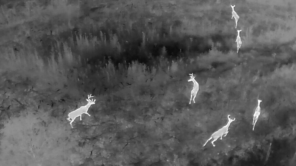
Thermal drone wildlife assessments in Waupun, Wisconsin provide landowners, farmers, and property managers with accurate, non-invasive insight into wildlife activity. Using advanced thermal imaging technology, we detect deer movement, monitor wildlife populations, and survey large properties quickly and efficiently — even in low-light or dense vegetation conditions. As an FAA Part 107 certified drone operator serving Dodge County, Fond du Lac County, and Green Lake County, we deliver professional, ethical, and data-driven wildlife surveys designed to support informed land management decisions.
Why Choose Thermal Drone Assessments
- Low Impact
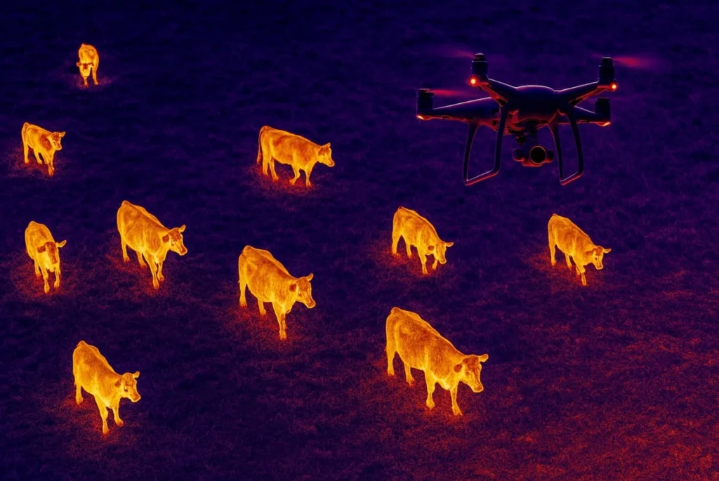
Drone wildlife surveys are non-invasive, reducing stress on animals and preventing habitat disturbance compared to ground-based monitoring. - Highly Accurate
Thermal imaging drones detect body heat, improving wildlife detection in tall grass, dense cover, and low-light conditions. - Faster Surveys
Drone thermal assessments cover large areas quickly, delivering accurate wildlife population data in a fraction of the time.
Who Benefits
- Landowners
Private landowners benefit from drone wildlife assessments to monitor deer movement, manage property wildlife activity, and make informed land management decisions. - Agriculture
Farmers use thermal drone wildlife surveys for deer detection, fawn rescue before mowing, and wildlife population monitoring to reduce crop damage and improve field safety. - Conservation Groups
Conservation organizations rely on thermal imaging drones for accurate wildlife population surveys, habitat monitoring, and non-invasive species tracking in protected areas. - Wildlife Organizations
Wildlife management agencies use drone thermal assessments for efficient animal counts, predator monitoring, and data-driven conservation planning.
How the Assessment Works
- Contact Form
Click or tap here to complete the form so we can review your project details and determine the best approach. - Fly
Our licensed pilot conducts a thermal drone wildlife survey, scanning the area using advanced infrared imaging to detect animals safely and efficiently. - Collect Data
We capture high-resolution thermal imaging data to identify wildlife locations, movement patterns, and population counts. - Deliver Video
You receive a detailed thermal wildlife survey video, giving you clear visual documentation of detections and activity across your property for informed land management decisions.
Service Area
- Fond du Lac County
- Dodge County
- Green Lake County
- South Central Wisconsin
Note mileage rates apply over 40 miles.
- Contact Form
- +1 920.210.8602
- info@lastlightrecovery.com
- Find Us on Google
Frequently Asked Questions
Is a thermal drone wildlife assessment legal?
Yes. Thermal drone wildlife assessments are legal when performed by an FAA Part 107 licensed drone pilot and conducted in accordance with all federal, state, and local regulations. We operate ethically, do not disturb wildlife, and always require landowner permission before flying over private property.
Is this ethical / does it disturb wildlife?
Yes and no. Thermal drone wildlife assessments are conducted in an ethical and responsible manner designed to minimize disturbance. Our drone allows us to locate animals quickly without prolonged ground searches, unnecessary pressure, or pushing wildlife from cover. We do not harass, chase, or intentionally disturb animals, and all operations are performed legally, respectfully, and with landowner permission.
Why do thermal drone wildlife assessments work so well?
Thermal imaging drones detect heat signatures, allowing us to locate wildlife that are hidden by tall grass, thick brush, woods, or low-light conditions. Unlike ground searches, thermal drones can cover large areas quickly and efficiently while minimizing stress on animals or your land.
When should I consider a thermal drone wildlife assessment?
Consider a thermal drone wildlife assessment when you need accurate, low-impact insight into wildlife activity on your property. Using advanced thermal imaging, assessments help identify deer movement, population presence, and habitat patterns — especially in low-light conditions.
What areas do you service?
We are based in Waupun, Wisconsin, and provide thermal drone deer recovery, lost pet recovery, livestock recovery, and wildlife services throughout South-Central Wisconsin. Our service area includes surrounding cities and counties such as Dodge County, Fond du Lac County, Green Lake County, Columbia County, and other nearby areas.
If you’re unsure whether you’re within our service range, contact us anytime and we’ll quickly let you know if we can assist—or help connect you with a trusted local drone recovery operator.